Texas Fishing Maps for Android Mobile Devices
Go Mobile with Google Earth! View and use your purchased Fishing Maps on your Mobile devices! Open and use our Texas Bay and Offshore Fishing Maps and Fishing spots with Google Earth (and several other GPS apps) right from the email we send after your purchase(s). Our mobile file works with Android or Droid Phones and Tablets using Google Earth and a variety of GPS Apps. This included Mobile fishing spots file shows incredibly clear chart overlay when zoomed in using the latest version of Google Earth on Android or Droid Mobile devices. See iPhone and iPad info here
Enjoy “Nautical View” Mobile Offshore Fishing Chart overlays available EXCLUSIVELY from Texas Fishing Maps and other affiliate States. This file loads to your Mobile Device with the Google Earth App and for better navigation options, use our suggested free GPS App. You’ll find the Information about our suggested free GPS app in the included instructions after purchase. This GPS Fishing Map file is included with any purchase. Once again, we’ve set the bar over the top for our competitors to follow! (All offshore fishing maps contain the overlay Nautical Chart. Some Bay charts may contain this chart overlay, but not all offer full detail for inshore areas.
Many of our Customers now use their fishing map and fishing spots with a Droid or Android Mobile device for planning fishing trips, reading comments on fishing spots and more! Our mobile file loads from your email directly to the free Google Earth App (and our recommended GPS App) on any Android or Droid device. Once you have purchased your fishing spots, we email you the proper file needed for using your Android device that’s almost like a Fishing GPS. This should only be an aid to your main GPS unit to assist in planning your trips and locating your spots along with viewing comments on the spots, bottom contours, breaks, depths and more.
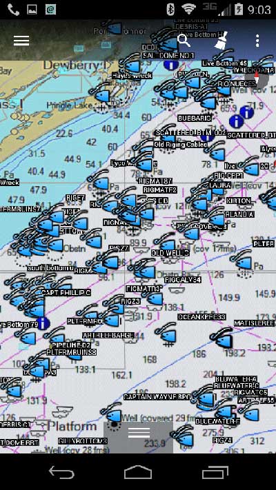
Note: Everything you need is included with any purchase including which Apps to use for loading our mobile fishing spots file. Offshore locations now include a nautical chart view along with your fishing spots as shown in the images. All purchases from any of our Websites, from any State, comes with “copy and paste” files for your boats GPS, Phone and Tablet.. All conveniently emailed the same day of purchase.
Got an iPhone-iPad? Click here if you’re looking for the iPhone or iPad GPS App info
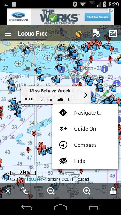
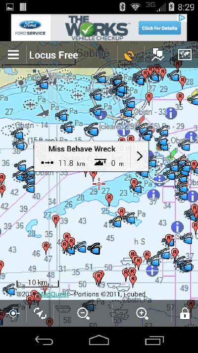
Below, see some of our Texas Fishing Spots loaded to the “Locus Free GPS” app. More simply, use your included Google Earth File with Google Earth as seen in the above image. Note that Google Earth displays a more “clear” chart overlay when zooming in close.


