Texas Fishing Maps for iPhone or iPad
Our iPhone and iPad Mobile Fishing Map file is Included with all Fishing Spots locations we offer! This file opens with Google Earth and several other GPS apps for light navigation using your mobile devices. Here, we have put together some general info about how your Mobile Device can be used as a GPS to help you find information about your fishing spots on the water and off the water. With this file loaded, a new world of on the water fishing technology is available from your Mobile device! Looking for Android information?
LOAD IN GOOGLE EARTH AND GO! – We’ve taken Google Earth to new levels for our fishermen! Our “Nautical View” file opens and views easily using the free Google Earth App and can be used on the water and off the water. (never use a mobile device as your sole means of navigation). — Grab the latest Google Earth App from the Market place and install it. Once installed, this file loads into Google Earth (on most versions) from the email we send after your purchase. Simple, fast and easy for all users with real world convenience and multiple uses on and off the water!
Exclusively from our Company: Enjoy our included Nautical Chart Overlay for Offshore Fishing Maps! This file links from our Map Server directly to your Mobile Device for improved Mobile viewing on your mobile device. See all your fishing spots, view depths, view offshore contours and breaks, wrecks, and other chart features like NOAA charts or Marine GPS charts, all from Google Earth (and other GPS apps) on your phone or tablet!
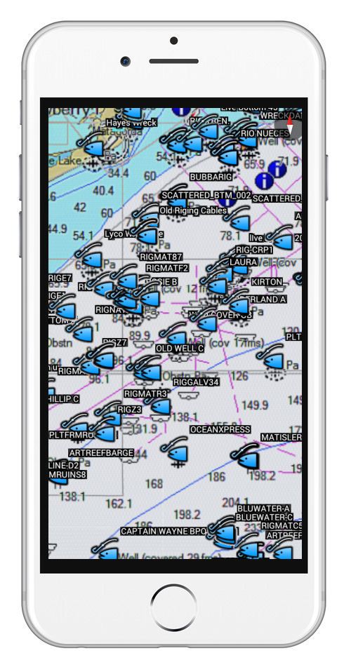
As shown in the iPhone image using the free Google Earth App here, our included mobile file offers users a Nautical Chart or NOAA Chart overlay included. This Fishing Chart overlay is available exclusively from GPS FISHING MAPS, LLC and our websites only. Always look for the blue oval logo at top of the page to be sure you’re shopping an official GPS Fishing Maps website. After purchase, load Google Earth, and we’ll also direct you to another GPS App for your iPhone or iPad to load, right from the email we send you! This file is usable as soon as you receive our email, delivered via email the same day of purchase.
Actual view shown here using our ‘Nautical View™’ Fishing Chart File on an iPhone.
Technology has really caught up with fishing, and we’re here to bring you the latest digital Fishing Maps and Fishing Spots for your iPad and iPhone. If you’re an Android or Droid user, see this page for Android Nautical Views. or your Android using a specially designed file that works with many GPS apps that accept Google Earth files.
Feel free to contact us with any questions about maps, purchases, fishing help or general information of any kind


