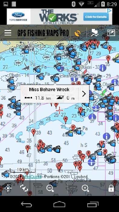
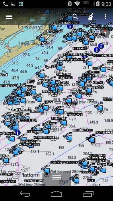
Texas Fishing Maps for mobile devices include an integrated NOAA nautical chart with depths, contours, wrecks and other topographical map detail. These files are included with any fishing spots purchase on this website. NOAA charts are dependable and up to date beyond anything else on the market. Enjoy mapping and detail, thanks to NOAA and other private map sources. These charts overlay the sea floor, depths, contours, navigation aids and more to your purchased fishing maps for mobile devices using several free or cheap GPS Apps.
This front running mobile fishing map technology is actually not an App, but a specially designed Google Earth file. This type of file is offered exclusively by GPS Fishing Map Co. We are the first designers to integrate NOAA Nautical Chart overlays that are linked to your purchased area(s) from our server and NOAA, all designed into one easy to use Google Earth file. You can tap spots to see comments on Google Earth and other GPS Apps that accept Google Earth files. (a couple of suggested GPS Apps are shown in the image here. The name of these Apps will be found in your setup Instructions)
Works with Android, iPhone and iPad Mobile Devices and computers!
Shoppers Note: Always be sure you see our BLUE OVAL LOGO on the header when shopping for Guide Level fishing maps online. This logo is found at all our websites in (9) Coastal States. We are the original and only company online working directly with fishing Guides to bring you a superior product to assist anglers in catching and locating fish. We’ve been in the fishing spots business for over 14 years online and on land.
Cutting Edge Fishing Map Technology! Shown to left is Matagorda-Corpus Christi Mobile Fishing Map using the free Google Earth App. This is the future of fishing along with electronic mapping using Mobile Devices. There are several advantages of this mapping system when used with your iPhone, iPad, Android or Droid Device. See them listed below.
*Use it with Google Earth on your devices, or use our suggested GPS Apps (App info sent in email to you)
*Any purchased Fishing spots and chart are built into one file for SIMPLE use! Greater detail is normally found on Offshore fishing maps.
* View Offshore Depth Contours and other chart options right from your Phone
* See locations of offshore breaks and rips on an around contours and shallow humps in offshore waters near your purchased fishing spots.
Contact our office anytime using our super-fast quick mail form found here! We’ll reply the same day.. ASAP! For phone orders or other information and help with our fishing spots in any state, the quick contact form should be used to expedite your answers or replies for sales or help. Thank you! —Dana King, Operations Manager – GPS Fishing Maps


